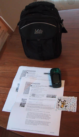
I got my gear together for the hike. I had my new Garmin Venture
GPS,
my new mini-pack, and the geocaching milagro Michele made me,
and the cache printouts.
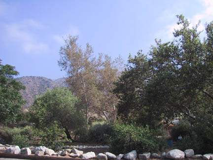
This is the base of Bailey Canyon park, looking up toward the hills.
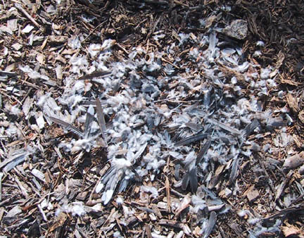
On my way in I saw these remains of bird that had been killed and eaten.
Look like the wilderness was close at hand.
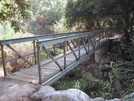
I saw this neat little bridge close to the beginning. It looked neat
and I assumed the
cool shady feeling would continue. The GPS said I was within 0.4
mile of the cache.
I thought I'd be there in a few minutes. I was wrong.
After a surprising long hike (it took about 45 minutes) I got close to the
cache.
This is looking down the hill. I hiked past the reservoir on the way
in.
I got close to the cache and wandered around a bit trying to track it
down.
My GPS keep telling me it was below the trail so I spent a while crawling
through the
underbrush and questioning why I go
geocaching as the yucca plants stabbed me.
I wandered above the trail and viola! The cache!
I took about 15 minutes to find the cache.
After a sigh of relief, I sat down for a rest and opened the cache.
I took the ruler and left a bag of Band-Aids and a gold dollar coin.
I was tired at this point, but continued up the trail.
This was a tough hike. I'm not kidding, this trail kicked my
ass. Endless switchbacks and quick rise in elevation had me
huffing and puffing and the sweat was pouring off me.
The GPS kept telling me I was 0.3 miles and I never seemed to get any
closer.
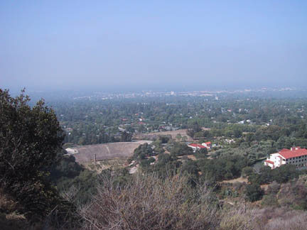
The switchbacks finally ended and I got this view down the trail.
Compare this to the picture down the hill near the first cache.
It was about a 2000 ft gain in elevation from where the trail started.
It took about an hour to reach this viewpoint from the first cache.
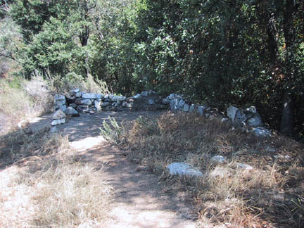
Here are the remains of cabin. After the long hike, the cool shade
felt wonderful.
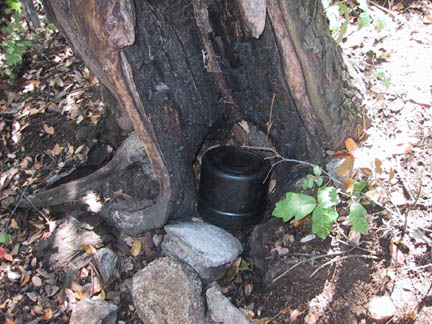
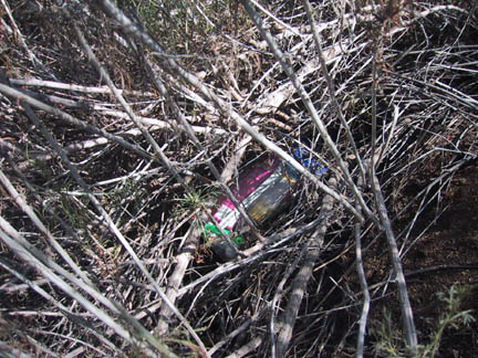
Here is the cache as I found it.
The last geocacher up here, LarsThorwald, had mentioned that the cache was
wet, so I
had brought paper towels and extra ziploc bags to see what I could do.
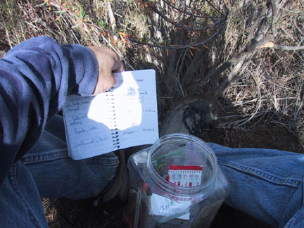
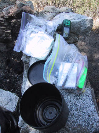
The cache was a little damp, so I dried everything and placed the items in
a clean dry bag.
I left the extra paper towels and bags in the cache just in case.
When I read the log, I saw that a non-geocacher had found the cache.
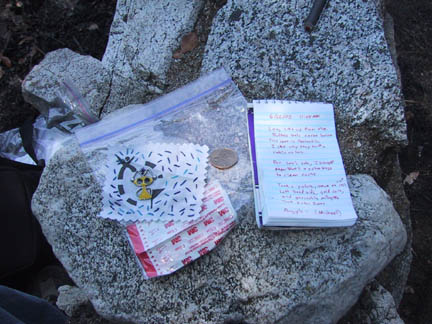
I took the picture frame and left a bag of band-aids, a gold dollar coin,
and a geocaching milagro.
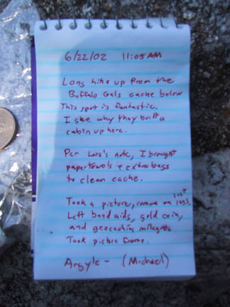
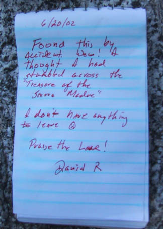
My entry in the log.
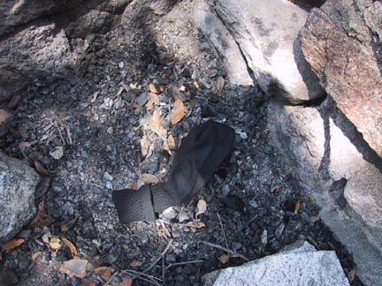
For some strange reason, someone had left a sock at the cabin.
I carried it out with the trash.
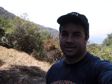
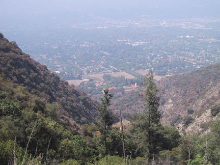
Here I am at the cabin. I was hoping you could see the city below.
I ate a food bar, drank some water, and rested a bit before heading down.
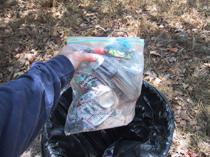
On the way out I picked up trash as I saw it. You know the 'Cache
in, Trash out' idea.
It took about 90 minutes to hike all the way down to the car.
If you ask for a tough hike, you just may get it.